Mada za sehemu hiiPhotograph Reading And InterpretationMada 4
These are the photographs taken on the level grounds when the optical camera axis is horizontal to the object. OR These photographs are taken from the ground when the camera is at the same level as the object being photographed.

Characteristics of Ground Level Photographs
- They show only the (front) side view of an object
- It is taken when the camera is near the to the ground
- Its scale decrease from the foreground to the background
- They have the optical camera axis horizontal to an object
Uses of Ground Level Photographs
- They are used for the identification of the objects because the features are shown clearly
- They are for ordinary photographs
These are the photographs taken from hills looking down with camera towards the ground. Sometimes they are taken from low flying planes, towers or from tall building.
Types of Oblique Photographs
- Low oblique Photographs
- High Oblique Photographs
Low Oblique Photographs
These are taken when the photographer is standing in elevated ground, such as top of a hill, building or cliff, and holds the camera at an angle pointing towards the lower ground.
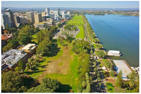
Characteristics of Low Oblique Photographs
- It covers a small area
- It does not show the horizon
- It shows the top and front views of the objects
- They are taken from an elevated area at 45° (for example: from the top of the mountain)
- The features in the fore and middle ground are shown clear
Uses of Low Oblique Photographs
- They are used for the identification of the objects because the features are shown clearly
- They can be used for geographical research
High Oblique Photographs
These photographs are taken from the sky with the camera tilted at an angle towards the ground. The photographer may take the photograph from a helicopter.

Characteristics of High Oblique Photographs
- They show large area
- They are taken at 60°
- They show the horizon
- They show both the front and top view
- They are important in map making
These are photographs taken with camera whose axis tilted vertically to the ground at right angle (90°). These are photographs taken from the aircraft with the camera directly above the object pointing vertically to the ground. Only the top view is seen. Instruments used to capture pictures are called aircrafts or the satellites.
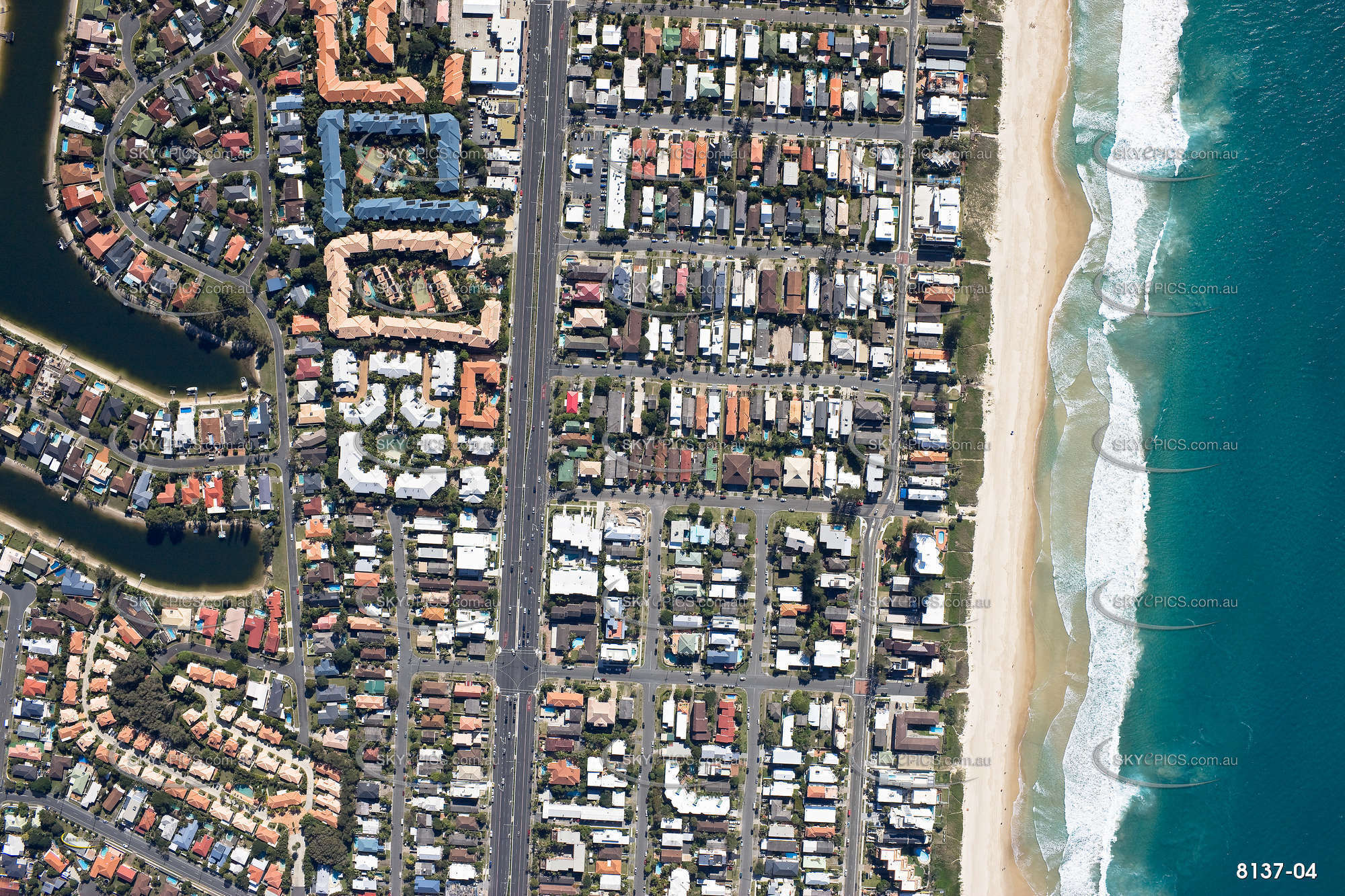
Characteristics of Vertical Aerial Photographs
- They show large areas
- They are taken from the air
- They are taken when the camera is placed vertically towards the object
- They can be used in map making
- They contain a lot of detailed information of a given photographic region since they print everything
Uses of Vertical Aerial Photographs
- They are used for plotting contour lines
- They are used for map making
- They are used for military purposes
- They can produce variety of scales like small scale and large scale
- They are used for pilot studies before conducting field trip
- They can be used for investigation or researches
- They can be also used for rapid survey of unknown area like thick forests and high mountains
Mwalimu
Unasoma somo hili? Niulize nikuelezee chochote kilichomo.
Ingia ili kumuuliza Mwalimu wa AI wa Sonza kuhusu mada hii.
Ingia ili kuulizaMajadiliano
Hakuna maswali bado