Mada za sehemu hiiPhotograph Reading And InterpretationMada 4
- Types of Photographs
- Reading and Interpreting Photographs
- Identifying and Interpreting Physical Features
- Identifying and Interpreting Human Activities
Many physical features shown in the photograph can be identified and interpreted. These features include relief, drainage, and vegetation, among others.
Refers to the physical configuration of the Earth's surface, including its variations in elevation, slope, and landforms. It describes the vertical and horizontal dimensions of land features in a given area, ranging from flat plains to steep mountains.
Key Components of Relief
-
Elevation: The height of a location above sea level. For example, Mount Kilimanjaro in Tanzania is 5,895 meters above sea level.
-
Slope: The gradient or steepness of the land surface. It can vary from gentle slopes (common in plains) to steep slopes (as found in mountainous regions).
-
Landforms: These are the natural physical features of the Earth's surface, shaped by geological and geomorphological processes.
Examples include:
- Mountains: High elevation and steep slopes, e.g., the Usambara Mountains.
- Plains: Flat or gently rolling areas, e.g., the Serengeti Plain.
- Plateaus: Elevated flat-topped areas, e.g., the Southern Highlands of Tanzania.
- Valleys: Low areas between hills or mountains, often with rivers, e.g., the Great Rift Valley.
Importance of Relief in Geography
- Influence on Climate — High-altitude areas are cooler and receive more rainfall compared to low-lying regions. For example, the Kilimanjaro region experiences cooler temperatures due to its elevation.
- Human Activities — Relief affects settlement patterns, agriculture, and transportation.
- Flat plains are suitable for farming and building infrastructure.
- Steep slopes in mountainous areas make construction and agriculture challenging.
- Water Distribution — Relief influences the flow of rivers and the formation of drainage systems. Rivers often originate from highlands and flow to low-lying areas.
- Tourism and Scenery — Unique relief features, such as mountains, valleys, and plateaus, attract tourists. For instance, Mount Kilimanjaro and the Ngorongoro Crater are popular tourist destinations in Tanzania.
Relief Features in the Photograph
Relief features in the photograph may include the following:
- Ridge — A narrow and long relief feature with steep slopes on all sides.
- Escarpment — An area of highland with very steep slopes on one side and a gentle slope on another side. The steep slope of an escarpment is called the scarp slope and the gentle slope is known as dip slope.
- Plateau — An extensive highland region whose top surface is almost flat. A plateau is easily identified on the map by the absence of contour lines on the higher land surface and with a series of contours close together on either side.
- Slopes — This inclination varies considerably, resulting in the following types of slopes: A concave slope is widely spaced at the lower ground and closely spaced at the higher ground. A convex slope, on the other hand, has a steep slope at the lower ground and a gentle slope at the higher ground.
- Col — A col is the land between two peaks of a mountain or in the mountain ranges.
- Saddle (Pass) — Generally wider than a col, saddles provide convenient passages across mountain ranges. Contours showing peaks are usually closed.
- Valley — The low-lying part of the land which is bound by higher ground and steep slopes. Valleys are indicated by contours forming a 'V' shape pointing to the higher ground, and some valleys have rivers flowing in them.
- Spur — A projection of the raised land from the side of a hill or mountain into lowland. Contours showing a spur form a 'V' shape pointing to the lower ground.
- Hills/Peaks — A rounded upland area not as high as a mountain. Hills rise above the general relative low ground but are less than a mountain. Hill height is usually about 350m-650m. Some hills are regular while others are irregular. A hilly landscape is shown on photographs as having varied relief of hills and valleys that are not isolated on a flat landscape.
- Cliff — A steep rock face that is vertical or nearly vertical. Cliffs are common in mountainous or hilly areas and along the shores of lakes and seas. On topographical maps, cliffs are shown by contours that are so closely packed that they appear to merge into one another.
- Plain — A continuous tract of relatively flat land covering a broad area of lowland. Some plains may be raised but the slopes are very gentle. Plains occur as lowlands and at the bottoms of valleys but also on plateaus or uplands at high elevations. On topographical maps, a plain is shown by contours that are very widely spaced. Some rivers, if present, may be seen to have meanders.
- Depression — A depression on a contour map is shown by contour lines with small marks pointing towards the lowest point of the depression. The first contour line with the depression marks and the contour line outside it have the same elevation.
- Mountain — Refers to the upland or highland over 1000m from the mean sea level.
Drainage features such as rivers, lakes and seas may easily be identified in all types of photographs. Different aspects of rivers can be studied on a photograph. These include the shapes of river valleys, stages of development and various features. Based on the presence of certain features, one can tell the nature of the rock over which the river flows. For example, the presence of rapids and waterfalls is an indication that the river is flowing over steep land.
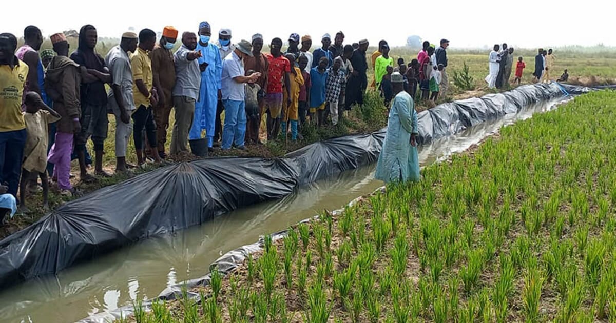
Photographs show all types of vegetation in the photographed area. Planted (artificial) and natural forests appear to be distributed unevenly, with planted forests usually in clear straight lines. In planted forests, trees tend to be of the same type, size and height because they were planted at the same time.

The types of crops grown and appearing on the photograph may give a clue on the type of soil in a photographed area. For example:
- Rice grows well in clay soil.
- Tea and coffee require volcanic soil.
- Coconuts and cashew nuts thrive well in coastal regions with sandy soils.
- Variety of horticultural crops thrive in loam soils.
Weather and climate are not shown directly on photographs. Features contained in a photograph can be used to make conclusions about the climate of a photographed area. The type of crops grown and vegetation on the photograph can be used as a clue to establish the climate of a place. Vegetation types and crops can also provide evidence about the season or climate of a place. For example:
- The presence of many cacti signifies an arid or semi-arid region, and hence a desert or semi-desert climate.
- Crops such as sisal are grown in hot areas that receive low rainfall while sugarcane thrives in warm to hot climate with high rainfall.
- The type of clothing people in the photograph are wearing can give an indication about the weather and possible climate.
Mwalimu
Unasoma somo hili? Niulize nikuelezee chochote kilichomo.
Ingia ili kumuuliza Mwalimu wa AI wa Sonza kuhusu mada hii.
Ingia ili kuuliza