Mada za sehemu hiiMap Reading And InterpretationMada 4
- Concept of Map Reading
- Reading and Interpreting Topographical Maps
- Methods of Showing Relief on Topographical Map
- Cross Section
Methods of Showing Relief on Topographical Map
Contour Lines
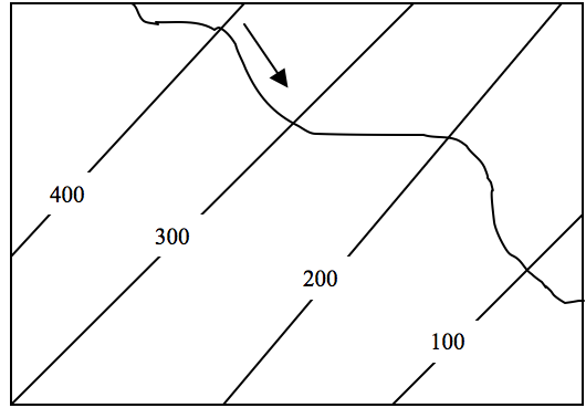
- These are lines drawn on topographical maps to join all places or areas with equal height or altitude from the mean sea level.
- Contours are very important in determining relief features, whether the relief is steep-sided or gently sloping.

Trigonometric Station
- This is a point on a map with its exact height fixed, usually on a hilltop, mountain peak, or other visible positions.
- They are the highest points in any locality.

Spot Height
- Spot height is a point on a map with its exact height above a known level, e.g., from the sea level.

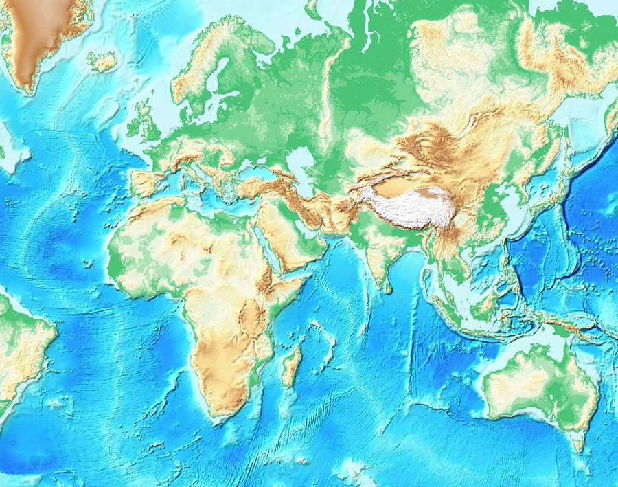
Layer Coloring / Tinting
- This is done to show the relief features on the map.
- Different coloring shades on the map indicate different heights.
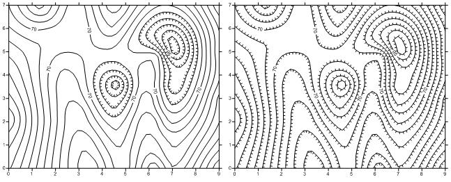
Hachures
- Hachures are short, broken lines drawn on a relief map.
- They show the direction and steepness of a slope.
Form Lines
- Form lines are usually unnumbered lines drawn on a map joining areas of nearly the same height.
- They are broken lines drawn between two contour lines.

Relief Features on Topographical Maps
Ridge
- A narrow and long relief feature with steep slopes on all sides.

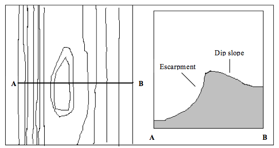
Escarpment
- An area of highland with very steep slopes on one side and a gentle slope on the other side.
- The steep slope of an escarpment is called the scarp slope, and the gentle slope is known as the dip slope.
Plateau
- A plateau is an extensive highland region whose top surface is almost flat.
- A plateau is easily identified on the map by the absence of contour lines on the higher land surface and with a series of contours close together on either side.

Slopes
- A slope is the inclination or slant of the land.
- This inclination varies considerably, resulting in the following types of slopes:
- Concave Slope:
- Widely spaced at the lower ground and closely spaced at the higher ground.
- Convex Slope:
- Has a steep slope at the lower ground and a gentle slope at the higher ground.

Col
- The land between two peaks of a mountain or in mountain ranges.

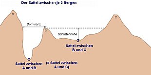
Saddle (Pass)
- A saddle is generally wider than a col.
- Saddles provide convenient passages across mountain ranges.
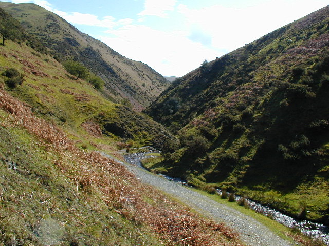
Valley
- A valley is the low-lying part of the land, which is bound by higher ground and steep slopes.
- Valleys are indicated by contours forming a 'V' shape, pointing towards the higher ground.
- Some valleys have rivers flowing in them.
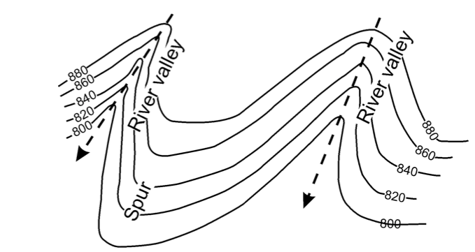
Spur (Salient)
- A spur is a projection of raised land from the side of a hill or mountain into lowland.
- Contours showing a spur form a 'V' shape pointing towards the lower ground.
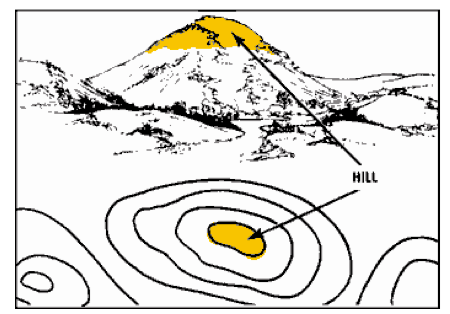
Hills/Peaks
- A hill is a rounded upland area not as high as a mountain.
- Hills rise above the general relatively low ground but are lower than a mountain.
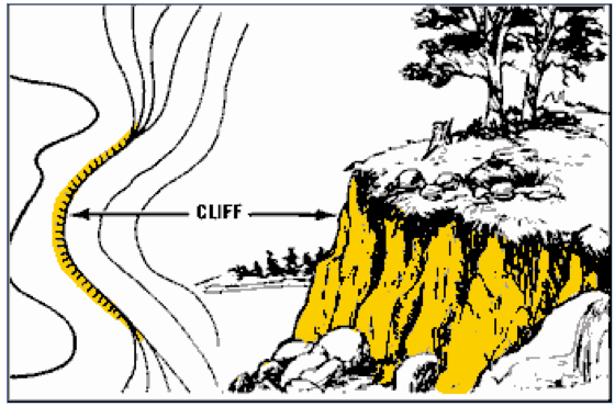
Cliff
- A cliff is a steep rock face that is vertical or nearly vertical.
- Cliffs are common in mountainous or hilly areas and along the shores of lakes and seas.
- On topographical maps, cliffs are shown by contours that are so closely packed that they appear to merge into one another.
Plain
- A plain is a continuous tract of relatively flat land covering a broad area of lowland.
- Some plains may be raised, but the slopes are very gentle.
- Plains occur as lowlands at the bottoms of valleys, but also on plateaus or uplands at high elevations.
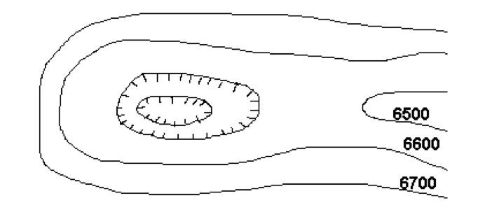
Depression
- A depression on a contour map is shown by contour lines with small marks pointing towards the lowest point of the depression.
- The first contour line with the depression marks and the contour line outside it have the same elevation.
Mountain
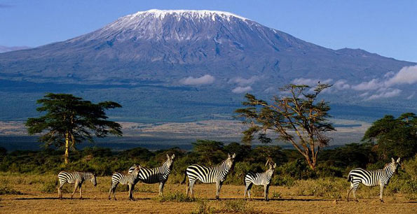
- A mountain refers to the upland or highland that is over 1000m above the mean sea level.
Mwalimu
Unasoma somo hili? Niulize nikuelezee chochote kilichomo.
Ingia ili kumuuliza Mwalimu wa AI wa Sonza kuhusu mada hii.
Ingia ili kuulizaMajadiliano
Hakuna maswali bado
Inapakia majadiliano…