Mada za sehemu hiiElementary Surveying And Map MakingMada 3
- Meaning and Types of Survey
- Chain Survey
- Levelling Survey
Levelling is a fundamental surveying process used to determine the height or elevation of different points on the Earth's surface. It is essential for creating accurate maps, planning construction projects, and assessing land slopes or gradients. The goal of levelling is to measure the difference in elevation between points, which helps in understanding the relative height between various land features.
-
Leveling Staff:
-
Description: A leveling staff is a long ruler-like tool used in levelling operations. It is typically made of steel and is divided into units (often marked in meters or feet) for precise height measurements.
-
Materials: It can be made of steel, and its markings can either be white and black or black and white, which enhances visibility depending on the surroundings.
-
Purpose: The leveling staff is used to measure the height of the ground at different points. It is placed vertically at the points of interest, and its height is then observed from a leveling instrument.
-
Design: It often has a telescopic or adjustable feature to allow for easy extension or retraction. The staff is generally divided into units such as centimeters and meters.
-
How It Works:
- The leveling staff is placed at a specific location (point on the ground), and the level instrument is used to measure the staff's reading.
- The difference between the readings at various locations gives the elevation difference (height).
-
-
Leveling Instrument:
- Common leveling instruments include dumpy levels, auto levels, and theodolites. These instruments are used in conjunction with the leveling staff to determine the height of different points accurately.
- Dumpy Level: A type of optical instrument used to establish horizontal lines and measure vertical distances.
- Auto Level: A more advanced instrument that automatically compensates for slight tilts and ensures that the measurements are more accurate.
- Theodolite: Although primarily used for measuring angles, the theodolite can also be used for precise levelling when combined with other equipment.
-
Setting up the Instrument:
- The leveling instrument (such as a dumpy level or auto level) is set up at a known reference point. The instrument must be level itself, and this is typically done using a spirit level.
-
Taking Readings:
- The leveling staff is placed at the point whose height is to be determined. The instrument operator looks through the leveling instrument and records the reading on the staff.
-
Determining Elevation Differences:
- By comparing readings at various locations, the difference in elevation between points can be calculated. These measurements help establish the relative heights of various land features.
- Construction Projects: Levelling is critical for ensuring the correct height of foundations, roads, railways, drainage systems, and more.
- Flood Risk Assessment: Levelling helps in determining flood zones by measuring elevations in relation to potential water levels.
- Mapping: Levelling data is essential for topographic maps, which display the elevation changes in terrain.

A survey telescope is a specialized optical instrument used in surveying to determine angles of position, elevation, or heights on the Earth's surface. It plays a crucial role in both angular measurement and height determination when used with leveling instruments or total stations.
-
Optical System:
- The survey telescope consists of lenses and an eyepiece that allow the operator to view distant objects clearly. The system is designed to provide accurate angular measurements.
-
Precise Angle Measurement:
- The telescope helps determine the horizontal and vertical angles between objects. By pointing the telescope at specific targets (such as landmarks or points on the ground), surveyors can measure angular deviations and calculate the relative position of those targets.
-
Instruments Used with Survey Telescopes:
- Survey telescopes are often mounted on devices like theodolites, total stations, or dump levels. These instruments allow the telescope to be used for both horizontal and vertical angle measurement.
-
Height Determination:
- When used with leveling instruments or total stations, the survey telescope can also help determine the height or elevation of different points on the Earth's surface. This is particularly useful in construction, road building, and terrain mapping.
-
Positioning the Telescope:
- The survey telescope is mounted on a surveying instrument like a theodolite or total station. The instrument is set up at a known location (a reference point) and is carefully leveled using a spirit level.
-
Sight the Target:
- The operator looks through the eyepiece of the telescope and aligns it with the point or feature whose angle or height needs to be measured.
-
Angle Measurement:
- Once the target is aligned, the instrument's angle measurement system records the horizontal and vertical angles between the instrument and the point being surveyed.
- The horizontal angle measures the direction from the instrument to the target, while the vertical angle measures the elevation difference between the instrument and the target.
-
Calculate Position or Height:
- By combining the angular measurements with known distances or reference points, surveyors can calculate the position of the target in terms of height (elevation) or other spatial coordinates.
- Topographic Surveying: Determining the relative heights and positions of natural and man-made features on the Earth's surface.
- Construction: Used in building foundations, roads, bridges, and other structures where accurate height measurements are critical.
- Geodesy: The measurement and monitoring of the Earth's shape, gravitational field, and other physical properties.
- Mapping: Essential for creating maps that include elevation data (contour lines) for navigation, planning, and development purposes.
-
Chain:
- Purpose: The chain is primarily used for measuring distances during the leveling process, especially for laying out specific points and ensuring accurate distances between them.
- Material: Typically made of steel, and divided into links that are used to measure long distances in leveling. It helps to measure the horizontal distance between reference points or benchmarks on the ground.
- Use in Leveling: The chain is stretched between two points to measure the horizontal distance. These distances can be used alongside leveling equipment to determine the elevation differences between points.
-
Pegs:
- Purpose: Pegs are used to mark station points on the ground during the leveling process. These are critical in marking the position of the instrument (like a leveling staff) and the reference points (benchmark) during a survey.
- Material and Size: Typically made of wood, with a length of about 40cm to 50cm and a width of 4mm square. Pegs are hammered into the ground to mark key locations where measurements are taken.
- Use in Leveling: Pegs ensure consistency by marking the position of reference points and station points to ensure accurate measurements and avoid confusion during the survey process.
-
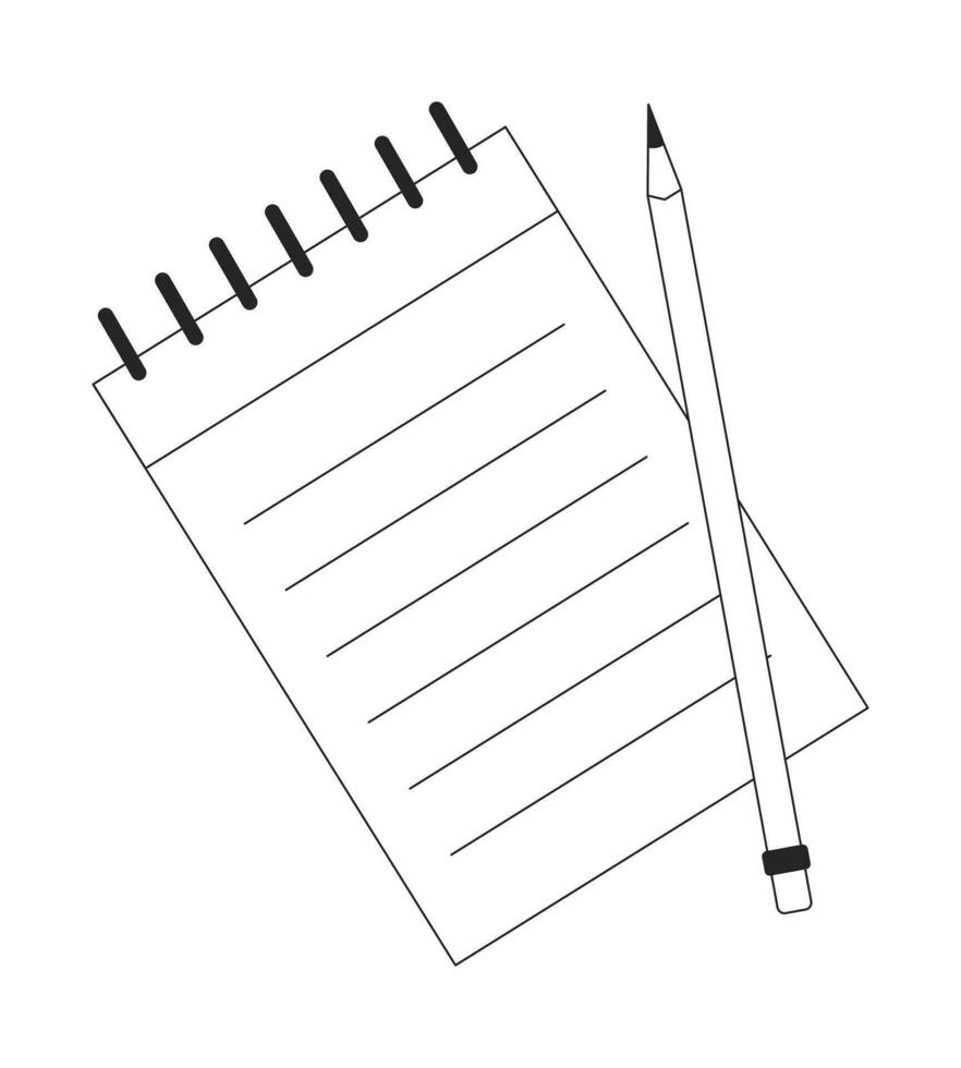
Notebooks:
-
Purpose: Surveying and leveling require precise record-keeping of measurements, observations, and calculations. A field notebook is essential for documenting data during the survey process.
-
Content: The notebook is used to record information such as:
- Distances measured using the chain or other instruments.
- Elevation changes at various points.
- Station positions marked with pegs.
- Details of the equipment used and any observations or remarks made by the surveyor.
- Any corrections or adjustments made during the survey.
-
-
Pencils:
- Purpose: Pencils are used to write in the field notebook because they are easier to correct and don't smudge easily, which is especially useful in outdoor conditions where weather can be unpredictable.
- Use in Leveling: Pencils are used to write down survey data, observations, and measurements immediately after they are taken to avoid errors or forgetting important details. For example, noting down the staff readings, reference points, or any changes in elevation during the leveling process.
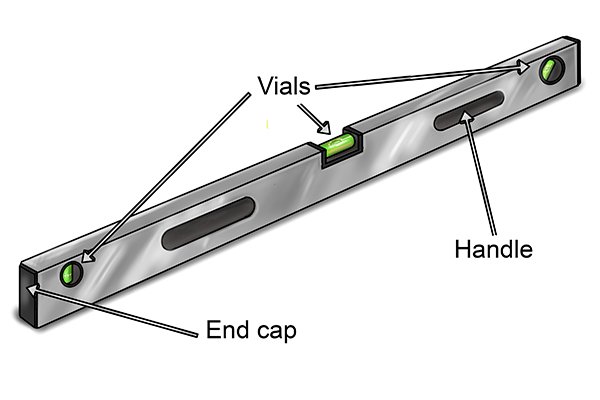
The spirit level or bubble tube is an essential tool used in leveling to ensure that the instrument is perfectly horizontal or level when taking measurements. This tool is particularly important for ensuring that the survey readings are accurate, as even slight tilts in the instrument can lead to errors in determining heights.
Features of Spirit Level / Bubble Tube
- Length: The bubble tube typically ranges from 50 mm to 225 mm in length. The specific length can vary depending on the instrument and the precision required for the survey.
- Mounted on the Telescope: The bubble tube is usually mounted directly on the telescope of a leveling instrument, such as a theodolite or auto-level.
- Bubble: The tube contains a small bubble of air, which moves along the tube. The position of the bubble indicates whether the instrument is level. The bubble will move to one side if the instrument is tilted, and it will rest in the center of the tube when the instrument is perfectly level.
Purpose and Function
- Ensures Horizontal Alignment: The primary purpose of the spirit level is to ensure that the instrument (theodolite or survey telescope) is horizontally aligned during measurements. It helps the surveyor check the leveling of the instrument, which is essential for obtaining accurate readings.
- Recording or Graduating Telescopic Staff: The spirit level is used to ensure that the line of sight (through the telescope) is perfectly horizontal when the surveyor is taking readings. The observer looks through the telescope and records measurements (usually on a graduated telescopic staff or leveling staff) from their own position, whose height is known. This allows for precise determination of elevation differences between two or more points on the land's surface.
How It Works
-
Positioning: The spirit level is placed horizontally on the telescope, and the surveyor uses it to check that the instrument is perfectly level.
-
Bubble Position:
- If the bubble is centered in the tube, the instrument is horizontal, and accurate measurements can be taken.
- If the bubble is displaced (either to the left or right), the instrument is tilted, and adjustments need to be made to level it.
-
Observation and Recording: Once the instrument is leveled, the surveyor looks through the telescope, and the graduated staff is read to record the height difference between the points of measurement.
Advantages
- Increased Accuracy: Ensures that the leveling instrument is aligned properly for precise readings, which is crucial for tasks like determining the elevation or height of various points on the surface.
- Simple and Effective: It's a straightforward tool that is easy to use and reliable for achieving horizontal alignment in the field.
- Versatility: It can be used in various types of leveling surveys, from simple height measurements to more complex topographic and engineering surveys.
- A staff is placed at station one or base station. Then the sighting instrument is put in the direction of travel when a back sight is recorded.
- The distance from base station to the instrument is measured.
- The staff man moves along the direction of travel ahead of the sighting instrument (telephone). This will be station two where a fore sight is recorded.
- The sighting instrument is moved along the direction of travel ahead of the staff man. A back sight is taken and recorded.
- It helps to determine the relative heights on land that can be used in contour mapping.
- Leveling can be used for determination of heights or elevation of the land surface such as hills, valleys, plans, etc.
- Housing foundation, the location of industrial sites, the route of communication and sites of building can be located and determine with the help of leveling.
Mwalimu
Unasoma somo hili? Niulize nikuelezee chochote kilichomo.
Ingia ili kumuuliza Mwalimu wa AI wa Sonza kuhusu mada hii.
Ingia ili kuuliza